GPS devices serve very different jobs: turn-by-turn car navigation, off-grid route finding, vehicle tracking, or emergency satellite messaging. I’d name the Garmin DriveSmart 66 my best overall pick for drivers who want a clear screen and voice assistance, while the Garmin eTrex 22x stands out for hikers seeking a rugged, map-ready handheld and the Bouncie GPS Tracker for connected vehicle monitoring. The main tradeoffs are screen size versus portability, offline navigation versus cellular connectivity, and upfront simplicity versus ongoing service needs. A car navigator won’t replace a trail GPS, and a tracker won’t guide you turn by turn. Read on for the full breakdown and help matching each device to its job.

Get movie nights delivered free with Prime
- Fast, free delivery on millions of items
- Prime Video, Amazon Music and more included
- Member-only deals all year
Key Takeaways
- The roundup splits into four distinct groups: car navigators, handheld outdoor GPS units, vehicle trackers, and a satellite communicator; choosing the right type matters more than comparing screen sizes across groups.
- Among the car models, the DriveSmart 66 balances a usable display and voice assistance, while the DriveSmart 76 favors a larger screen and the Drive 53 keeps the experience simpler.
- The eTrex 22x and 32x prioritize rugged offline outdoor use; the 32x adds compass and barometric altimeter functions, while the GPSMAP 65 is the specialist pick for challenging reception conditions.
- Vehicle trackers such as Bouncie, Tracki Pro, and LandAirSea 54 depend on connected tracking rather than turn-by-turn guidance, so buyers should check service requirements, reporting behavior, and installation needs.
- The inReach Mini 2 fills a different safety role: satellite communication beyond cellular coverage, not a general-purpose mapping device or substitute for a dedicated trail GPS.
| 7-inch GPS Navigator for Car – 2026 North America Maps with Free Lifetime Updates |  | Best for Mixed Vehicle Types | Screen size: 7 inches | Display: Touchscreen | Map coverage: North America | VIEW ON AMAZON | See Our Full Breakdown |
| Garmin DriveSmart 66, 6-inch Car GPS Navigator with High-Resolution Maps and Voice Assist |  | Best Connected Car GPS | Display size: 6 inches | Display resolution: High-resolution | Map coverage: North America | VIEW ON AMAZON | See Our Full Breakdown |
| Garmin eTrex 22x Handheld GPS Navigator |  | Best Rugged Trail Navigator | Display: 2.2-inch sunlight-readable color display | Display resolution: 240 x 320 pixels | Preloaded maps: Topo Active with routable roads and trails | VIEW ON AMAZON | See Our Full Breakdown |
| Garmin eTrex SE GPS Handheld Navigator |  | Best for Long Battery Life | Display: 2.2-inch high-resolution | Battery life: Up to 168 hours in standard mode; up to 1,800 hours in expedition mode | Battery type: Two AA batteries, not included | VIEW ON AMAZON | See Our Full Breakdown |
| Handheld GPS for Hiking, Waterproof and Rugged Navigator with 3.2″ Sunlight Readable Screen and USA Topo Map |  | Best Large-Screen Handheld | Screen size: 3.2 inches | Display: Sunlight-readable LCD | Touch control: Non-touchscreen; physical buttons | VIEW ON AMAZON | See Our Full Breakdown |
| Tracki Pro GPS Tracker for Vehicles, 4G LTE, Long Battery Life |  | Best for Long-Term Asset Tracking | Battery life: 2–12 months | Battery capacity: 10,000mAh | Connectivity: 4G LTE Cat1 | VIEW ON AMAZON | See Our Full Breakdown |
| Garmin Drive 53 GPS Navigator, 5″ Touchscreen, Driver Alerts, North America Maps (Renewed) | 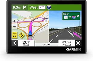 | Best Compact Car Navigator | Screen size: 4.97 inches | Resolution: 480 x 272 | Display: Backlit WVGA glass multi-touch | VIEW ON AMAZON | See Our Full Breakdown |
| 7-Inch GPS Navigator for Car, Truck, RV with 2026 Maps and Lifetime Free Updates |  | Best Large-Screen Value for Mixed Vehicles | Screen size: 7 inches | Display: Touchscreen | Connectivity: USB | VIEW ON AMAZON | See Our Full Breakdown |
| Bouncie GPS Tracker for Vehicles with Real-Time Location |  | Best for Vehicle Diagnostics and Driving Insights | Connection type: OBD2 | Vehicle compatibility: Vehicles from 1996 onward | Subscription: Monthly subscription required | VIEW ON AMAZON | See Our Full Breakdown |
| Garmin GPSMAP 65 Handheld GPS with Multi-Band and Expanded Satellite Support |  | Best for Challenging Outdoor Navigation | Screen size: 2.6 inches | Display resolution: 160 x 240 | Display type: LCD color display | VIEW ON AMAZON | See Our Full Breakdown |
| Garmin inReach Mini 2 Satellite Communicator |  | Best for Backcountry Safety | Device type: Satellite communicator | Messaging: Two-way satellite messaging | Emergency feature: Interactive SOS | VIEW ON AMAZON | See Our Full Breakdown |
| Garmin DriveSmart 76, 7-inch Car GPS Navigator with High-Resolution Maps and Voice Assist |  | Best for Feature-Rich Car Navigation | Display size: 7 inches | Map coverage: North America | Voice features: Voice assist and Alexa built-in | VIEW ON AMAZON | See Our Full Breakdown |
| Garmin Drive 53 GPS Navigator |  | Best for Straightforward Driving Directions | Display: 5-inch glass capacitive touchscreen | Map coverage: North America | Directions: Spoken turn-by-turn directions | VIEW ON AMAZON | See Our Full Breakdown |
| LandAirSea 54 GPS Tracker |  | Best for Tracking Vehicles and Assets | Model: 54 | Device type: GPS tracker | Connectivity: Global tracking | VIEW ON AMAZON | See Our Full Breakdown |
| Garmin eTrex 32x Rugged Handheld GPS Navigator |  | Best for Rugged Trail Navigation | Screen size: 2.2 inches | Display resolution: 240 x 320 | Map type: Topo Active topographical maps | VIEW ON AMAZON | See Our Full Breakdown |
| gps device | Connectivity | Battery life |
|---|---|---|
| 7-inch GPS Navigator for Car | USB | — |
| Garmin DriveSmart 66 | Wi-Fi, Bluetooth, Garmin Drive app | — |
| Garmin eTrex 22x Handheld GPS | — | Up to 25 hours |
| Garmin eTrex SE GPS Handheld N | — | Up to 168 hours in standard mode; up to 1,800 hours in expedition mode |
| Handheld GPS for Hiking | USB | Up to 36 hours |
| Tracki Pro GPS Tracker for Veh | 4G LTE Cat1 | 2–12 months |
| Garmin Drive 53 GPS Navigator | USB | 1 hour |
| 7-Inch GPS Navigator for Car | USB | — |
| Bouncie GPS Tracker for Vehicl | — | — |
| Garmin GPSMAP 65 Handheld GPS | Bluetooth and ANT+ | Up to 16 hours |
| Garmin inReach Mini 2 Satellit | Bluetooth | Up to 14 days in 10-minute tracking mode |
| Garmin DriveSmart 76 | — | — |
| Garmin Drive 53 GPS Navigator | — | — |
| LandAirSea 54 GPS Tracker | Global tracking | — |
| Garmin eTrex 32x Rugged Handhe | — | Up to 25 hours |
More Details on Our Top Picks
7-inch GPS Navigator for Car – 2026 North America Maps with Free Lifetime Updates
This model’s main advantage over the Garmin DriveSmart 66 is its range of vehicle routing modes: car, truck, RV, bicycle, and pedestrian. Truck and RV settings are described as avoiding low bridges and restricted roads, which can help drivers steer clear of routes that do not fit their vehicle. Its 7-inch touchscreen also offers more viewing area than the DriveSmart’s 6-inch display. Voice guidance and alerts for speed limits and school zones add useful prompts without requiring constant screen checks. The tradeoff is that the available details are thinner on connected features: USB is listed, but live traffic or smartphone services are not. Map coverage is North America, and downloading other regions requires contacting support, so this is a better fit for regional drivers than international travelers.
Pros:- Vehicle-specific truck and RV routing is designed to avoid low bridges and restricted roads
- 7-inch touchscreen gives routes and turns more viewing space than the Garmin DriveSmart 66
- Includes 2026 North America maps with free lifetime updates
- Voice guidance includes turn, speed-limit, and school-zone alerts
Cons:- Live traffic and smartphone-connected services are not specified
- Update frequency is not stated
- Additional map regions require contacting support
Best for: RV and truck drivers who want a large screen, vehicle-specific routing, and North America maps with lifetime updates
Not ideal for: Drivers who depend on live traffic, connected phone features, or maps outside North America
- Screen size:7 inches
- Display:Touchscreen
- Map coverage:North America
- Map updates:Free lifetime updates; 2026 maps
- Vehicle compatibility:Bus, car, RV, truck
- Routing modes:Car, truck, RV, bicycle, pedestrian
- Connectivity:USB
- Controls:Touch and voice
Our verdict“Choose this navigator if you want a large-screen GPS with truck or RV routing, but skip it if connected traffic services are a priority.”
Garmin DriveSmart 66, 6-inch Car GPS Navigator with High-Resolution Maps and Voice Assist
The Garmin DriveSmart 66 is the strongest fit here for drivers who want a car navigator tied to phone-based services, rather than the vehicle-specific routing offered by the 7-inch North America GPS Navigator. Pairing with a smartphone can provide live traffic, weather, and parking information, while voice assist and hands-free calling help keep routine controls off the screen. Alexa and built-in travel directories add flexibility on road trips. Its 6-inch high-resolution display is smaller than the 7-inch navigator’s, but the connected feature set is broader. Those extras depend on a paired phone, and Alexa functions can add distractions if used while driving. This model also focuses on North American maps, so it is not the right choice for trips requiring broader map coverage.
Pros:- High-resolution 6-inch display presents maps clearly
- Smartphone pairing provides access to live traffic, weather, and parking updates
- Voice assist and hands-free calling support phone-free operation
- Alexa and travel directories add road-trip information and entertainment
Cons:- Live updates and Alexa require a paired smartphone
- Voice and entertainment features may distract some drivers
- Map coverage is limited to North America
Best for: North American drivers who want a dedicated car GPS with phone-linked traffic, hands-free calling, and voice features
Not ideal for: RV or truck drivers who need specified vehicle-specific routing, or travelers who need maps beyond North America
- Display size:6 inches
- Display resolution:High-resolution
- Map coverage:North America
- Connectivity:Wi-Fi, Bluetooth, Garmin Drive app
- Voice features:Garmin voice assist, Alexa built-in
- Driver information:Driver alerts, live traffic, weather, and parking updates via smartphone pairing
- Built-in travel features:HISTORY database, U.S. national parks directory, Tripadvisor ratings
- Charging:Dual USB charger included
Our verdict“Pick the DriveSmart 66 if connected driving services matter more than a larger screen or dedicated truck and RV routing.”
Garmin eTrex 22x Handheld GPS Navigator
Unlike the vehicle-focused DriveSmart 66, the Garmin eTrex 22x is built around outdoor navigation, with preloaded routable Topo Active maps for roads and trails. Its sunlight-readable color display and rugged design suit hikers and cyclists who need a dedicated handheld device away from a car dashboard. GPS and GLONASS support offer two satellite systems, while up to 25 hours from two AA batteries gives it practical endurance for day trips and longer outings. The tradeoff is a 2.2-inch screen: it is far smaller than the 3.2-inch handheld GPS in this lineup, so inspecting detailed map areas takes more attention. AA power is easy to replace on the trail, but it also means carrying spare batteries rather than relying on a built-in rechargeable pack.
Pros:- Preloaded Topo Active maps include routable roads and trails
- Sunlight-readable color screen supports outdoor viewing
- GPS and GLONASS satellite support
- Up to 25 hours of operation with two AA batteries
Cons:- 2.2-inch display is smaller than the 3.2-inch handheld GPS in this roundup
- AA batteries require spares or replacement during extended outings
- Small screen can make detailed map viewing less convenient
Best for: Hikers and cyclists who want a rugged handheld with preloaded trail mapping and replaceable AA power
Not ideal for: Users who want a large map display, rechargeable battery, or a car-focused navigation system
- Display:2.2-inch sunlight-readable color display
- Display resolution:240 x 320 pixels
- Preloaded maps:Topo Active with routable roads and trails
- Satellite support:GPS and GLONASS
- Internal memory:8 GB
- Battery life:Up to 25 hours
- Battery type:Two AA batteries
Our verdict“Choose the eTrex 22x for rugged trail navigation and replaceable batteries, but opt for a larger-screen handheld if map detail is your priority.”
Garmin eTrex SE GPS Handheld Navigator
For long outings where changing batteries is inconvenient, the Garmin eTrex SE stands apart from the eTrex 22x with up to 168 hours in standard mode and 1,800 hours in expedition mode. Its multi-GNSS support spans GPS, GLONASS, Galileo, BeiDou, and QZSS, giving it more satellite-system options than the 22x’s GPS and GLONASS pairing. A digital compass, IPX7 water resistance, and wireless software updates add practical trail utility. The compromise is its simpler mapping approach: the product data does not list preloaded detailed topographic maps, while the eTrex 22x includes routable Topo Active maps. Its 2.2-inch screen is compact, and two AA batteries are not included, so buyers should plan their power supply before heading out.
Pros:- Long operating life of up to 168 hours in standard mode and 1,800 hours in expedition mode
- Supports GPS, GLONASS, Galileo, BeiDou, and QZSS
- IPX7 water resistance suits wet-weather outings
- Digital compass, geocaching support, and wireless software updates
Cons:- Detailed preloaded topographic maps are not specified, unlike on the eTrex 22x
- Requires two AA batteries, which are not included
- 2.2-inch display limits the map area visible at once
Best for: Backpackers and geocachers who prioritize extended battery life, water resistance, and broad satellite-system support
Not ideal for: Hikers who want detailed preloaded topo mapping or a rechargeable battery included with the device
- Display:2.2-inch high-resolution
- Battery life:Up to 168 hours in standard mode; up to 1,800 hours in expedition mode
- Battery type:Two AA batteries, not included
- Water resistance:IPX7
- Supported satellite systems:GPS, GLONASS, Galileo, BeiDou, QZSS
- Additional navigation features:Digital compass and geocaching support
- Software updates:Wireless updates supported
- App compatibility:Garmin Explore app
Our verdict“Choose the eTrex SE for long battery endurance and broad satellite support, but pick the eTrex 22x if preloaded trail maps matter more.”
Handheld GPS for Hiking, Waterproof and Rugged Navigator with 3.2″ Sunlight Readable Screen and USA Topo Map
This handheld’s 3.2-inch sunlight-readable screen gives it a clear viewing advantage over both Garmin eTrex models, each of which has a 2.2-inch display. That extra area can make checking a topo map easier without turning the unit into a touchscreen device; this model uses physical buttons, which may suit wet-weather operation but feels less direct for users accustomed to touch controls. It includes USA Topo maps, supports multiple satellite systems, and is rated IP66 for water resistance. The stated battery life of up to 36 hours is shorter than the eTrex SE’s standard-mode figure, though it uses a rechargeable battery rather than replaceable AA cells. Product data lists Windows as its operating system, so buyers should check software and update compatibility before relying on it for a trip.
Pros:- 3.2-inch sunlight-readable screen is larger than the 2.2-inch Garmin eTrex displays
- Preloaded USA Topo map supports outdoor route viewing
- Multi-GNSS support includes BeiDou, GPS, Galileo, and QZSS
- Rechargeable battery is rated for up to 36 hours
Cons:- Physical buttons only; there is no touchscreen
- Up to 36 hours is below the eTrex SE’s stated standard-mode battery life
- Windows operating system may limit compatibility with some software or update workflows
Best for: Hikers who want a larger readable topo-map screen, physical controls, and rechargeable power in a handheld GPS
Not ideal for: Users who prefer a touchscreen, need long expedition-mode battery life, or want clearly documented software compatibility
- Screen size:3.2 inches
- Display:Sunlight-readable LCD
- Touch control:Non-touchscreen; physical buttons
- Map type:USA Topo
- Satellite systems:BeiDou, GPS, Galileo, QZSS
- Battery life:Up to 36 hours
- Water resistance:IP66
- Memory storage:32 GB
- Connectivity:USB
Our verdict“Pick this handheld if screen size and rechargeable power matter more than touchscreen control or the eTrex SE’s longer stated runtime.”
Tracki Pro GPS Tracker for Vehicles, 4G LTE, Long Battery Life
The Tracki Pro is a better fit for keeping tabs on a parked vehicle, trailer, or other asset than for turn-by-turn travel: it reports location through a subscription-based service and can remain in sleep mode for up to 12 months. Its magnetic, weatherproof design gives it more flexible placement than the plug-in Bouncie, though the Bouncie adds vehicle diagnostics and driving insights that Tracki does not list. Global coverage across 185+ countries makes this a more adaptable choice for assets that travel internationally, while its 5–10 meter outdoor accuracy is aimed at location monitoring rather than precision surveying. The tradeoff is ongoing service cost, and the 18-ounce unit is not as unobtrusive as a tiny tracker. I’d skip it for tracking people or pets; it is designed for vehicles and assets.
Pros:- Up to 12 months of battery life in sleep mode
- Magnetic, weatherproof housing supports flexible vehicle and asset placement
- 4G LTE service with coverage in more than 185 countries
- Outdoor GPS accuracy listed at 5–10 meters
Cons:- Full functionality requires a subscription
- At 18 ounces, it may be bulky for discreet placement
- Some accessories are product-specific
Best for: Owners of trailers, vehicles, or equipment who want a weatherproof tracker with flexible mounting and long intervals between battery maintenance
Not ideal for: People or pet owners seeking a personal tracker, or buyers who do not want a subscription-based tracking service
- Battery life:2–12 months
- Battery capacity:10,000mAh
- Connectivity:4G LTE Cat1
- Coverage:185+ countries
- Outdoor GPS accuracy:5–10 meters
- Size:3.54 x 2.48 x 1.46 inches
- Weight:18 oz / 263g (as listed)
- Weatherproof:Yes
Our verdict“Choose the Tracki Pro for long-term vehicle or asset monitoring with flexible placement, but pick the Bouncie if vehicle diagnostics and driving insights matter more.”
Garmin Drive 53 GPS Navigator, 5″ Touchscreen, Driver Alerts, North America Maps (Renewed)
The renewed Garmin Drive 53 suits drivers who want a dedicated navigator with straightforward menus rather than a larger, feature-heavy dashboard screen. Its 4.97-inch capacitive touchscreen, spoken directions, and driver alerts cover the basics in a compact format; the 7-Inch GPS Navigator offers a larger display and vehicle-specific routing, making that alternative easier to read and more adaptable for trucks or RVs. The Drive 53’s North America maps and 16 GB of storage keep the focus on conventional road guidance, but its listed battery life is only about an hour, so it is best used on its mount with USB power. Since this unit is renewed, buyers should also check the seller’s condition and support details. It is a practical pick for cars, but less compelling for drivers who prioritize screen size or extensive routing options.
Pros:- Compact touchscreen with simple menus
- Spoken turn-by-turn directions and driver alerts
- North America map coverage
- Dashboard and windshield mounting options
Cons:- Listed battery life is approximately one hour
- Smaller screen than the 7-inch navigator in this roundup
- Renewed condition may mean buyers need to check seller-specific support and item condition
Best for: Car, minivan, and SUV drivers who want a compact dedicated GPS with spoken directions and driver alerts
Not ideal for: RV and truck drivers who need a larger display or customizable vehicle-specific routing, and buyers seeking long unplugged operation
- Screen size:4.97 inches
- Resolution:480 x 272
- Display:Backlit WVGA glass multi-touch
- Map coverage:North America
- Battery life:1 hour
- Storage:16 GB
- Connectivity:USB
- Mounting:Dashboard mount and windshield mount
Our verdict“Choose the renewed Drive 53 for uncomplicated car navigation in a compact format, but favor the 7-inch navigator if screen space and vehicle-specific routing are priorities.”
7-Inch GPS Navigator for Car, Truck, RV with 2026 Maps and Lifetime Free Updates
This 7-inch navigator stands out for drivers who want a roomy display and routing aimed at cars, trucks, and RVs without moving to a premium connected model. Its voice-guided directions, speed-camera alerts, and customizable routes offer a broader road-trip feature set than the compact Garmin Drive 53, while the 2026 North America maps and advertised lifetime updates reduce concern about map freshness. The windshield mount and FM transmitter also give drivers options for placing the unit and hearing directions through a vehicle audio system. The tradeoff is limited product detail: software-update support is listed as undetermined, and warranty information is not specified. I would choose it for screen size and stated vehicle flexibility, but buyers who value a clearly documented update and support experience may prefer a Garmin model with more fully specified features.
Pros:- Seven-inch touchscreen provides a larger viewing area than the Garmin Drive 53
- Advertised 2026 North America maps with lifetime free updates
- Customizable routing for cars, trucks, and RVs
- Includes a windshield mount and FM transmitter
Cons:- Software-update support status is listed as undetermined
- Warranty details are not specified in the product information
- The provided specifications do not identify battery life or detailed display resolution
Best for: Drivers switching between a car, truck, or RV who want a large screen, voice guidance, and customizable route options
Not ideal for: Buyers who need well-documented software support and warranty terms, or who prefer a familiar established Garmin interface
- Screen size:7 inches
- Display:Touchscreen
- Connectivity:USB
- Map coverage:North America
- Map version:2026 maps, as advertised
- Map updates:Lifetime free updates, as advertised
- Routing:Customizable routes for cars, trucks, and RVs
- Included accessories:Windshield mount and FM transmitter
Our verdict“Pick this navigator for a large screen and stated multi-vehicle routing, but choose a better-documented model if update support and warranty terms are your main priorities.”
Bouncie GPS Tracker for Vehicles with Real-Time Location
The Bouncie is the strongest choice here for owners who want more than a vehicle’s location: its OBD2 connection provides vehicle health data alongside trip history, driving insights, geofencing, and accident-detection alerts. Compared with the Tracki Pro, it is easier to install in compatible cars and gives more information about how the vehicle is being driven, but it relies on the OBD2 port and is not the better fit for trailers or assets without one. Its compatibility with vehicles from 1996 onward covers many everyday cars, though owners should confirm their vehicle has a compatible port. The ongoing subscription is a real commitment, even with no hidden activation or return fees listed. I’d choose it for family vehicle oversight or fleet visibility; for long-term, flexible placement away from an OBD2 port, the Tracki Pro is the more suitable option.
Pros:- Plugs into the OBD2 port for straightforward installation
- Combines real-time location with driving insights and vehicle health data
- Includes geofencing and accident-detection alerts
- Supports vehicles from 1996 onward
Cons:- Requires a monthly subscription
- Works only with compatible vehicles equipped with an OBD2 port
- Less flexible to place than the magnetic Tracki Pro
Best for: Families and small fleet operators who want location tracking plus trip records, driving insights, and vehicle health monitoring
Not ideal for: Owners of trailers or equipment without an OBD2 port, and drivers who do not want an ongoing subscription
- Connection type:OBD2
- Vehicle compatibility:Vehicles from 1996 onward
- Subscription:Monthly subscription required
- Location:Real-time tracking
- Trip records:Unlimited trip history
- Monitoring features:Driving insights and vehicle health
- Alerts:Geofencing and accident detection
Our verdict“Choose Bouncie if you want location tracking paired with vehicle data and driving insights; choose Tracki Pro for flexible placement on trailers or other assets.”
Garmin GPSMAP 65 Handheld GPS with Multi-Band and Expanded Satellite Support
The GPSMAP 65 is the outdoor specialist in this group: its multi-band support and expanded GNSS reception are intended to help maintain location accuracy in challenging environments where a car navigator is the wrong tool. The sunlight-readable 2.6-inch color display and preloaded TopoActive maps support hiking and camping, while public land boundaries add useful context for outdoor route planning. At up to 16 hours of battery life, it is suited to a full day on the trail, though the small screen and button-operated controls are less immediate than the touchscreen Garmin Drive 53. Its North America map coverage also limits its appeal for international trips, and it lacks Wi-Fi. I’d pick this over the car-focused navigators for backcountry use, but hikers seeking a simpler handheld may prefer the Garmin eTrex 22x or eTrex SE alternatives.
Pros:- Multi-band and expanded GNSS support for challenging reception conditions
- Sunlight-readable color screen
- Preloaded TopoActive maps and public land boundaries
- Battery life listed at up to 16 hours
Cons:- Button-operated interface may feel less intuitive than the touchscreen Garmin Drive 53
- Listed map coverage is limited to North America
- No Wi-Fi connectivity
Best for: Hikers and campers who need a rugged handheld with enhanced satellite reception and topographic mapping for North American outings
Not ideal for: Drivers seeking turn-by-turn road navigation, international travelers needing broader included map coverage, or buyers who prefer touchscreen controls
- Screen size:2.6 inches
- Display resolution:160 x 240
- Display type:LCD color display
- Battery life:Up to 16 hours
- Satellite support:Expanded GNSS and multi-band frequency support
- Maps:Preloaded TopoActive maps; North America coverage
- Connectivity:Bluetooth and ANT+
- Memory:microSD
Our verdict“Choose the GPSMAP 65 for handheld hiking and camping where satellite reception and topo maps matter more than a large touchscreen.”
Garmin inReach Mini 2 Satellite Communicator
The inReach Mini 2 is for people who need a way to communicate beyond mobile coverage, not a replacement for a conventional road or trail navigator. Its two-way satellite messaging, interactive SOS, and location sharing add a safety and coordination layer that the Garmin eTrex 32x does not provide. Bluetooth pairing with Garmin Explore supports trip planning, while the compact, water-resistant design is easier to carry than a dedicated mapping handheld. The tradeoff is ongoing access: full satellite features require an active subscription, and rules on satellite communicators vary by jurisdiction. Its satellite focus also means buyers seeking detailed on-device topographic maps may prefer the eTrex 32x. Choose this for communication and emergency capability in remote areas; skip it if your main need is turn-by-turn navigation or you do not want a subscription.
Pros:- Two-way satellite messaging, interactive SOS, and location sharing support communication beyond cellular coverage
- Compact, lightweight form is easier to carry than a mapping-focused handheld such as the Garmin eTrex 32x
- Water resistance suits outdoor trips
- Bluetooth connection to Garmin Explore supports trip planning and mapping
Cons:- Full satellite features require an active subscription
- Satellite communication devices are regulated or prohibited in some jurisdictions
- Not a substitute for a dedicated navigator with detailed on-device topographic maps
Best for: Hikers, paddlers, and backcountry travelers who need satellite messaging and SOS capability outside cellular coverage
Not ideal for: Drivers or hikers primarily seeking detailed on-device maps, and anyone unwilling or unable to maintain a satellite subscription
- Device type:Satellite communicator
- Messaging:Two-way satellite messaging
- Emergency feature:Interactive SOS
- Location feature:Location sharing
- Battery life:Up to 14 days in 10-minute tracking mode
- Water resistance:Yes
- Connectivity:Bluetooth
- Trip-planning compatibility:Garmin Explore app
Our verdict“Choose the inReach Mini 2 when off-grid communication and emergency support matter more than standalone map navigation.”
Garmin DriveSmart 76, 7-inch Car GPS Navigator with High-Resolution Maps and Voice Assist
The Garmin DriveSmart 76 is the strongest fit here for drivers who want a large navigation screen plus connected road-trip features. Its 7-inch display gives directions more room than the Garmin Drive 53’s 5-inch screen, which can make route details easier to read at a glance. Voice assist, hands-free calling, and driver alerts add convenience, while live traffic, weather, and other connected services can broaden the trip information available when paired with a compatible smartphone. Wi-Fi updates are a practical advantage for maintaining maps and software without relying on a computer. That extra capability also brings more setup and connectivity dependence than the simpler Drive 53; some features rely on a phone, and Alexa functions should not distract from driving. Pick it for a feature-rich car navigator, not for off-grid handheld use.
Pros:- Large 7-inch display offers more viewing area than the Garmin Drive 53
- Voice assist and hands-free calling add useful in-car control options
- Live traffic, weather, and smart notifications are available with compatible smartphone pairing
- Built-in Wi-Fi supports map and software updates
Cons:- Some features depend on pairing with a compatible smartphone
- Connected services are less useful when phone connectivity is unavailable
- Alexa features require careful use to avoid distracting the driver
Best for: Drivers who want a large-screen North America navigator with voice assistance, hands-free calling, and smartphone-connected trip features
Not ideal for: Drivers who prefer a simple, phone-independent navigator or want a compact handheld for hiking
- Display size:7 inches
- Map coverage:North America
- Voice features:Voice assist and Alexa built-in
- Calling:Hands-free calling
- Connected features:Live traffic, weather, traffic cams, parking, and smart notifications
- Navigation features:Driver alerts and Garmin Real Directions
- Updates:Wi-Fi connectivity for map and software updates
- Included accessory:Dual USB charger
Our verdict“Choose the DriveSmart 76 if you want a large-screen car GPS with connected conveniences and can accept smartphone-dependent features.”
Garmin Drive 53 GPS Navigator
The Garmin Drive 53 suits drivers who want a dedicated navigator for core routing rather than the broader connected feature set of the DriveSmart 76. Its 5-inch touchscreen presents spoken turn-by-turn directions and North America maps in a smaller, simpler format, while alerts for school zones, speed changes, and sharp curves add useful context to the route. TripAdvisor points of interest and a national parks directory help with planning stops without making this model a satellite communicator or outdoor mapping handheld. Compared with the DriveSmart 76, it gives up the larger screen, voice assist, hands-free calling, and listed connected services. That makes it a more focused choice, but buyers should not assume map-update terms or voice-command support that are not specified in the product data. Choose it for basic dedicated car navigation; skip it if you want extensive connected features.
Pros:- High-resolution 5-inch touchscreen provides a dedicated view for route guidance
- Spoken turn-by-turn directions reduce reliance on checking a phone screen
- Alerts cover school zones, speed changes, and sharp curves
- TripAdvisor points of interest and a national parks directory support route planning
Cons:- North America map coverage may not suit international travel
- Smaller display offers less viewing area than the Garmin DriveSmart 76
- Voice-command capability and map-update terms are not specified in the product data
Best for: Drivers who want a dedicated North America GPS with spoken directions and road alerts, without needing a large screen or extensive connected features
Not ideal for: Drivers who want a 7-inch display, hands-free calling, voice assist, or the connected services offered by the Garmin DriveSmart 76
- Display:5-inch glass capacitive touchscreen
- Map coverage:North America
- Directions:Spoken turn-by-turn directions
- Navigation feature:Garmin Real Directions
- Road alerts:School zones, speed changes, and sharp curves
- Points of interest:TripAdvisor points of interest
- Directory:National parks directory
Our verdict“Choose the Drive 53 for focused, spoken North America car navigation, but pick the DriveSmart 76 for a larger screen and more connected features.”
LandAirSea 54 GPS Tracker
The LandAirSea 54 fills a different GPS role from the Garmin navigators: it reports an item’s location rather than giving a driver or hiker routes to follow. Its magnetic, waterproof housing supports discreet placement on vehicles or other assets, and motion-activated sleep mode is designed to reduce battery drain when the tracker is stationary. Through the SilverCloud app, the device offers real-time location updates and geofencing; the listed update interval can be as fast as every three seconds. By comparison, the Garmin Drive 53 is built for visible turn-by-turn guidance, not remote asset monitoring. The central tradeoff is the required monthly subscription, which adds an ongoing service commitment. This is a purpose-built tracking pick, not a general navigation device, and buyers should account for the service requirement before choosing it.
Pros:- Magnetic, compact design supports discreet placement on vehicles and assets
- Waterproof construction suits exposed installation locations
- Motion-activated sleep mode is designed to extend battery life while stationary
- SilverCloud app supports real-time location updates and geofencing
Cons:- Requires a paid monthly subscription to function
- Ongoing service costs add to total ownership expense
- Tracks location but does not provide the route guidance offered by the Garmin Drive 53
Best for: Vehicle owners and asset managers who need app-based location updates, geofencing, and a discreet waterproof tracker
Not ideal for: Hikers or drivers who need maps and turn-by-turn directions, or buyers who do not want a recurring service subscription
- Model:54
- Device type:GPS tracker
- Connectivity:Global tracking
- Location service:SilverCloud app
- Location updates:As fast as every 3 seconds
- Tracking features:Real-time location updates and geofencing
- Design features:Magnetic, waterproof, motion-activated sleep mode
- Subscription:Required
- Warranty:Lifetime warranty
Our verdict“Choose the LandAirSea 54 for subscription-based remote tracking of vehicles or assets, not for navigating a route.”
Garmin eTrex 32x Rugged Handheld GPS Navigator
The Garmin eTrex 32x is the lineup’s dedicated choice for hikers and cyclists who need topographic navigation in a rugged handheld. Its preloaded Topo Active maps and support for GPS and GLONASS are better suited to trail use than the car-focused Garmin Drive 53, while the 3-axis compass and barometric altimeter provide orientation and elevation information beyond basic route guidance. Up to 25 hours of battery life from two AA batteries makes power management straightforward on longer outings, though carrying spares becomes part of the plan. The compromise is viewing comfort: the 2.2-inch display is much smaller than either car navigator’s screen, and its 8 GB of internal storage may call for a microSD card when adding maps. Pick it for durable outdoor navigation, not large, easy-to-scan maps.
Pros:- Preloaded Topo Active maps are suited to hiking and cycling
- GPS and GLONASS support offer two satellite systems for positioning
- 3-axis compass and barometric altimeter add orientation and elevation information
- Up to 25 hours of battery life with replaceable AA batteries
Cons:- Small 2.2-inch screen limits map detail at a glance compared with the Garmin Drive 53
- Uses two AA batteries, so longer trips may require carrying spares
- 8 GB of internal storage may require a microSD card for additional maps
Best for: Hikers and cyclists who want a rugged handheld with preloaded topographic maps, compass and altimeter tools, and replaceable batteries
Not ideal for: Drivers who want a large turn-by-turn screen, or outdoor users who prioritize expansive map viewing and substantial onboard storage
- Screen size:2.2 inches
- Display resolution:240 x 320
- Map type:Topo Active topographical maps
- Supported satellite systems:GPS and GLONASS
- Internal storage:8 GB
- Expandable storage:microSD slot
- Battery life:Up to 25 hours
- Battery type:2 AA batteries
- Outdoor sensors:3-axis compass and barometric altimeter
Our verdict“Choose the eTrex 32x for rugged trail navigation and outdoor sensors, but not if a large map display is your priority.”

How We Picked
I grouped these 15 GPS devices by the job they perform rather than treating them as interchangeable. For car units, I weighed screen readability, route guidance, voice controls, map coverage, and ease of use. For handhelds, I focused on ruggedness, sunlight readability, mapping support, physical controls, and positioning features that matter away from roads. For trackers and the satellite communicator, I looked at connectivity, how each device fits into everyday monitoring or off-grid safety, and the ongoing setup or service considerations a buyer should verify.
The order favors usefulness for the widest likely audience within each category, then gives specialized devices credit for solving narrower problems well. The DriveSmart 66 leads as a balanced car navigator; the larger DriveSmart 76 and simpler Drive 53 serve different driver preferences. Outdoor models rank by the kind of navigation and reception demands they address, while trackers are judged as monitoring tools rather than route guides. These products are not direct substitutes, so I make the category boundaries and tradeoffs visible instead of declaring one device best for every use.
Factors to Consider When Choosing Gps Devices
Before choosing among GPS devices, identify the job you need done and where the device must work. The following distinctions can prevent a common mismatch: buying a tracker when you need directions, or relying on a phone where coverage and battery life may be uncertain.
Match the device type to the task
Start by deciding whether you need route guidance, position recording, remote vehicle monitoring, or off-grid communication. A dashboard navigator gives driving directions but does not monitor a parked vehicle for you. A vehicle tracker reports location through its supported connection and generally is not a substitute for a road map and spoken turns. A handheld GPS is built around outdoor position finding and routes, while a satellite communicator is primarily for messaging and emergency contact beyond cellular service. Buying by the word “GPS” alone can leave you with a device that locates you but does not perform the task you had in mind.
Check coverage and offline capability
Map coverage and network coverage are different things. Car navigators and many handheld units can use stored maps, which helps when mobile data is unavailable, but map detail and update policies vary. Trackers may rely on cellular networks to send location reports, so a tracking feature can become limited where coverage is weak. Satellite communicators address that gap through a separate satellite service, but they are not a replacement for detailed local maps. Before buying, check the specific region you plan to use and whether the core functions still work when the device has no connection.
Choose screen size, controls, and portability together
A large display can make road instructions easier to read at a glance, but it takes up more dashboard space and is less convenient to carry on a hike. Handheld outdoor units often trade a phone-like interface for physical controls that can be easier to operate with gloves or in wet conditions. Small satellite communicators pack easily, yet their compact size limits how much information they can show at once. Think about where the device will sit, how you will interact with it, and whether you need to use it one-handed. A spec-sheet screen measurement matters less than comfortable, safe access in your actual setting.
Account for reception conditions and route difficulty
Open roads and open trails place different demands on a receiver. Dense tree cover, steep terrain, and built-up areas can make position acquisition more challenging than driving on ordinary roads. Features such as expanded satellite support or multi-band reception are most relevant when you expect difficult conditions, not simply because they sound more advanced. For straightforward routes, a simpler handheld may be easier to use and carry. Match reception capabilities to the places you visit, and do not treat any GPS receiver as a guarantee of perfect positioning in every environment.
Look beyond the device to service and upkeep
A GPS purchase can involve more than the hardware. Trackers and satellite communicators may require an active plan or service for connected functions, while map-based devices call for attention to update availability and storage. A claimed long battery life does not tell the whole story if reporting frequency, temperature, or signal conditions change how often you recharge. Check charging options, mounting or installation needs, account setup, and what happens when a subscription ends. These details can matter more to long-term usability than an extra feature you may rarely use.
Pay for capabilities you will actually use
Premium features make sense when they solve a recurring problem: a larger in-car display for frequent drivers, stronger positioning support for demanding outdoor routes, or satellite messaging for trips outside cellular coverage. They are harder to justify when your routes are familiar and basic guidance is enough. A simpler car navigator may be a better fit for occasional trips, while a rugged handheld earns its place when you need offline wayfinding and durable controls. Separate must-haves from occasional conveniences before comparing models. That approach keeps specialized hardware from becoming an expensive backup you rarely carry.
Frequently Asked Questions
Can one GPS device handle driving, hiking, and vehicle tracking?
Usually not well, because these devices are built around different tasks. A car navigator prioritizes road routes and glanceable directions, while a handheld GPS is designed for outdoor positioning and route use. A tracker sends location information for a vehicle and may depend on a network or service plan; it does not normally provide the same navigation experience. The inReach Mini 2 adds satellite communication rather than replacing a full mapping unit. If you regularly need more than one function, choose the primary use first and treat the other device as a separate tool.
Do I need cellular service for a GPS device to show my location?
Not always: receiving satellite positioning and sending information are separate functions. Many dedicated navigators can determine location without cellular data, and devices with stored maps can continue to support offline navigation within their map coverage. A connected vehicle tracker typically needs a supported network to report its location remotely, even if it can determine its own position. Satellite communicators use satellite networks for messaging, subject to device capability and service arrangements. Check which features work offline, not just whether the product description says it has GPS.
Is a larger car GPS screen worth choosing over a smaller one?
A larger screen can make route prompts and map details easier to see, especially if the unit sits farther from the driver. It also takes up more dashboard or windshield space, which may be awkward in a compact vehicle. A smaller unit can be easier to position and store, but the displayed information may feel less comfortable to read at a glance. Consider your vehicle layout, mounting position, and how much map detail you want visible while driving. The best fit is the screen you can read clearly without obstructing your view.
Should I choose a handheld GPS with extra reception features for hiking?
That depends on where you hike and how much you rely on precise positioning. Extra satellite support and multi-band reception can be useful in challenging settings such as tree cover or terrain that limits a clear view of the sky. For maintained trails and open areas, a more basic handheld may meet your needs with less complexity. Reception features do not replace route planning, map knowledge, or carrying a backup way to navigate. Base the choice on your usual terrain rather than assuming the most advanced receiver is necessary for every outing.
What should I check before buying a GPS tracker or satellite communicator?
First, confirm what connection the device uses and whether the places you need it have that coverage. Then check whether remote reporting or messaging requires a service plan, how frequently the device can report, and what setup or charging routine it needs. A vehicle tracker is meant to help monitor a vehicle, while a satellite communicator is intended for communication beyond cellular coverage; neither role should be assumed from the word GPS alone. Review the device’s mounting, portability, and emergency-use limits as well. Those checks help prevent a device from failing to meet expectations when you need its connected features.
Conclusion
For most drivers seeking a dedicated navigator, I’d choose the Garmin DriveSmart 66 as the best overall balance in this lineup. The 7-inch GPS Navigator for Car is the best value-minded direction for buyers who want a large display and lifetime map updates, while the Garmin DriveSmart 76 is my premium choice for drivers who prefer a bigger screen and voice assistance. Beginners who want straightforward car guidance can start with the Garmin Drive 53. For hiking, choose the eTrex 22x for rugged offline navigation or the GPSMAP 65 when reception features matter most; for vehicle monitoring, compare Bouncie, Tracki Pro, and LandAirSea 54 around connectivity and service needs. If off-grid messaging is the priority, the inReach Mini 2 fills that specific role. Pick by task first, then narrow the choice by screen, durability, coverage, and ongoing requirements.
Fall Picks
fall essentials
As an affiliate, we earn on qualifying purchases.